The scientific field of the Department of Surveying and Geoinformatics Engineering
Studies at the Department of Surveying and Geoinformatics Engineering of the Univeristy of West Attica cover all topics related to the scientific disciplines and technologies of Surveying and Geodesy, Photogrammetry, Cartography and Geoinformation. In this context, our Curriculum focuses, on one hand, on the design of surveying projects and their subsequent application in technical construction works of infrastructure, and, on the other hand, on the methods of acquisition, processing, geo-referencing, mapping, management and visualisation of quantitative and qualitative spatial information.
Objective
The Department of Surveying and Geoinformatics Engineering offers high-level scientific and technological education, and aims at advancing the development and dissemination of knowledge in the wider scientific and technological field of Surveying and Geoinformatics, based on both theoretical and practical teaching as well as applied and technological research. It provides students with the necessary qualified knowledge, which can guarantee a successful professional career and progress.
At the same time, our graduates have the qualifications for responding to the changing scientific, technological, economic and social conditions within the national and international frameworks, in which the Surveying and Geoinformatics Engineers practice their profession. In this direction, the Department of Surveying and Geoinformatics Engineering collaborates with productive units and agencies related to our constantly extending field, while developing national and international links and cooperation with institutions, agencies and enterprises active in similar research areas.
Graduate profile
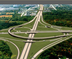
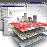
Thanks to their education according to our department Curriculum, graduates of the Department of Surveying and Geoinformatics Engineering have: a sound theoretical background in mathematics and natural sciences, special qualifications in acquisition, measurement and analysis of spatial data, specialized geomatics knowledge and expertise in producing and handling land information. With these qualifications, our graduate is fully capable of successful activity in both the public and private sectors in: a) all kinds of land survey, b) geodetic, photogrammetric and cartographic projects, c) land information and cadastral projects, d) design and stake out of projects related to road construction, hydraulic and other technical works, e) building and maintenance of Geographical Information Systems, f) interdisciplinary teams in transportation, hydraulics or town and regional planning as well as environmental projects, etc.
Studies
The 4 years of studies at the Department of Surveying and Geoinformatics Engineering are divided into 8 semesters. The Curriculum covers all basic scientific and technological fields, which are necessary for practicing the profession of the graduate Surveying & Geoinformatics Engineer. Studies are completed after students have successfully followed 40 courses. The curriculum is structured on the basis of Student Work Load and follows the European Credits Transfer System (ECTS).
The first semesters mainly include general background courses in natural and theoretical sciences, along with several introductory courses. There follow a series of more specialized background courses, while in the last semesters students are taught the specialization courses which provide Surveying & Geoinformatics Engineers with their particular identity. Besides mandatory courses, a limited number of elective courses (4 out of 8) are also included in the Curriculum, offering students the possibility for more profound knowledge in the areas of their particular interest. The final semester is devoted to the ‘practical exercise' (practicum) and the completion of their Diploma Thesis, as a more thorough treatment of a topic of application or of applied technological research related to the particular fields of the department degree.
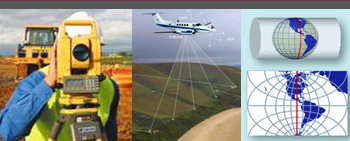
The studies give an emphasis on preparing students to familiarize themselves with the constantly evolving scientific and technological developments, but also on developing their capability to anticipate and respond successfully to changing conditions in their future activities. These changes emanate from new possibilities provided by advances in technology as well as in hardware and software, in areas including satellite technology, laser scanning and other range measuring technologies, imagery from multiple sources, etc. Thus, emphasis is laid on modern geodetic methods and automation of techniques in surveying, automation in photogrammetry & remote sensing and use of images acquired with modern technology, employment of state-of-the-art software in cartography, and on processing and management of spatial information.
|